WORKSHOP ON THE PROJECT “ASSESSING LAND VALUE CHANGES AND DEVELOPING A DISCUSSION SUPPORT TOOL FOR IMPROVED LAND USE PLANNING IN THE IRRIGATED LOWLANDS OF CENTRAL ASIA” (LAVACCA)
The Project “LaVaCCA” is implemented as part of the Volkswagen Foundation’s Initiative “Between Europe and the Orient - A Focus on Research and Higher Education in/on Central Asia and the Caucasus”. The project duration is 2015–2017.
The Project objectives are:
- assessing changes of land productivity in the Aral Sea basin under conditions of cross-cutting economic interests;
- developing win-win options of the usage of abandoned or marginal land;
- applying RS methods for solution of real-world problems.
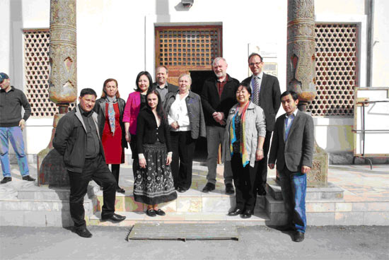
The midterm workshop of the Project was held in the city of Urgench (Uzbekistan) on 7-9 April 2016. The 3-day workshop agenda included:
- reporting for 2015 and result assessment;
- presentations by project PhD students;
- work plan for 2016.
Under the work package WP 1, the University of Wurzburg completed all administrative arrangements in order to organize activity of all project partners (two German institutions – University of Wurzburg and ZEF (Bonn)), KRASS (Urgench), SIC ICWC, and Karakalpakstan Agrarian University.
The cloud service was arranged to exchange project data, access was opened to the Mendeley Desktop (reference manager), the Masters study for student Alfiya Khaliullina was organized as part of the MS student program “Agricultural and food economics” (AFECO) at Bonn University (supervisors J.Lamers and V.Dukhovniy), and Mr. Murodjon Sultanov from Urgench University was adopted as a project PhD student with the second research supervisor C.Conrad.

Young researchers from the LaVaCCA Project also took part in a workshop on “Stakeholder Engagement in Research” that was organized on 14 - 17 September 2015 in Almaty, Kazakhstan.
Besides, over the reporting period, two handbooks were drafted on the stratification of field observation objects and for in-situ sampling and field observation for the purposes of RS image interpretation.
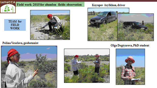
Research work under WP2 was carried out over the selected sites in Kzyl-Orga province (Kazakhstan), in Khorezm province and the Republic of Karakalpakstan (Uzbekistan). Using one common methodology, the researchers have studied soil and groundwater properties and have conducted in-situ investigations of grain, cotton, rice, and maize development and of abandoned land with the help of measuring equipment to estimate photosynthesis and active radiation for their further correlation with RS-based indices (NDVI, SAVI, NAGI, DVI, RVI, GCI, TCG). It was found that biophysical indices fit well grain yield for April-May and cotton and rice yield for July and August. Researchers from KRASS tried to interpret RS measurements through soil salinity in 0–75 cm layer. At the same time, they tried to simulate salinity using the combination of models HYDRUS and MODFLOW.
The Kazakh researchers identified phyto-diversity of abandoned land, depending on years of land development, by using also RS measurements and determined biometrical parameters of alfalfa and rice.
The work package 3 was focused on mapping of rice areas, alfalfa areas, and abandoned land by using RS. The resulting accuracy was 98% for rice fields, 87% for alfalfa fields, and 93% for abandoned land.
The work package 4 presented the results of field work in the experimental fields in Kulovat irrigation scheme (Khorezm province), where ground-based observations (including phenological ones) were carried out over cotton and rice in WUA “Airankul” and WUA “Istikbol”. Land productivity was assessed on the basis of a land productivity programming methodology, which was developed in the SANIIRI Institute and later on finalized in SIC ICWC by Prof. V.A.Dukhovniy, S.A.Nerozin, G.V.Stulina, and G.F.Solodkiy. Explanation of this methodology was published in form of a booklet (in Russian and English) and uploaded to the CAWater-Info Portal (www.cawater-info.net). Detailed soil studies and analysis were made. In particular, 240 soil samples were taken in 16 sites and analyzed for humus content, nutrients, and salinity. This allowed detecting, by using also the productivity methodology, that yield losses mainly result from the lack of phosphorus and potassium and the poor leveling of fields that cause irregular wetting, i.e. underwetting in some spots and overwetting in others.
The work package 5 was dedicated to environmental and socio-economic drivers of land productivity development. Those drivers should help to detect the picture of agricultural land use changes (acreage and yield) that lead to transformation of land into marginal state or to higher risk of land productivity losses (abandonment). Based on 16-day cycle of MODIS NDVI from 2003 to 2014, more than 90% of satellite images were statistically analyzed for Khorezm and Kzyl-Orda province, as well as for Fergana. Relationship between the land abandonment and the water supply was found for land schemes. The analysis showed that cotton yield in the Fergana province depended on water supply, soil quality and field leveling. Here, soil quality is influential. Availability of images from NOAA-AVHRR, Landsat and other satellites was analyzed as well.
Supposedly WP 5 will give a possibility to use RS in assessment of spatial patterns of indicators and drivers that shape land productivity changes.
The work package 6 task was to make the economic estimations of land value. Methodological approaches for assessment of land value from the state’s and farmer’s standpoints were studied. Normative approach, market approach and their combination were considered and a need was noted to assess productivity potential by using the more efficient evaluation of management system on the basis of WP4 work. The following indicators are to be considered in the estimations: cost-benefit, various cropping patterns, associated effect on production quantity and revenue (value of processing chain).
Normative value is estimated on the basis of indicators for Uzbekistan. Besides, polling of farmers was conducted as part of WP4 to know their opinion about possibilities to improve land value. For the market-based valuation, the land bonitet, available infrastructure, land demand proceeding from demographic conditions, including population density, and the degree of market development are considered.
Socio-economic and agricultural assessment results were analyzed for Elliqkala scheme and the Republic of Karakalpakstan in general.
|