SIC ICWC HAS COMPLETED ITS SECOND EXPEDITION TO THE EXPOSED BED OF THE ARAL SEA
The expedition to the exposed seabed was undertaken by SIC ICWC with the involvement of the International Innovation Center for the Aral Region and with the support of UNDP.
The expedition took place from 28 May to 26 June 2020 as a follow-up of the autumn expedition in 2019.
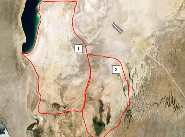
Target areas of two expeditions
The aim of the expedition was to undertake integrated monitoring of the exposed seabed. The expedition team included environmentalist, soil expert, botanist, forest expert, hydrogeologist, and GIS and RS experts.
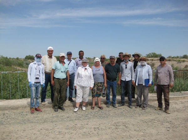
Expedition team
The target area of the exposed seabed stretched from the Amu Darya River channel (delta and avantdelta) to the Kokdarya River and Togyzarkan stream, from 53 m BSL to water edge of the Eastern Sea (maximum possible approximation).
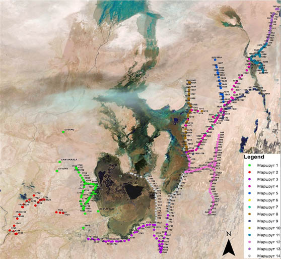
Second expedition route
The routes were chosen based on uncontrolled classification of satellite images and close to the routes of previous expeditions.
Two camps were established during the expedition. The first camp near Kazakhdarya settlement covered the route from the Amu Darya channel to Dzhiltyrbas bay. Three sites were studied.
The second camp was organized within the boundaries of nearly destroyed GTZ’s central camp. This site was chosen because of self-discharging well available there with slightly saline water.
Nine sites were studied from this camp between Dzhiltyrbas, the Kokdarya River and an area between the Kokdarya and Togyzarkan stream (extension of Kitaiskiy collector drain).
In total, the studied area covered more than 600,000 ha and the cars ran the distance of 2850 km.
As a result, the ground-based expedition enabled:
- full description of 562 points in situ for image identification;
- botanical description of vegetation, identification of plant formations;
- determination of the status of natural vegetation and afforestation, including varieties, height and projective coverage by vegetation in all stories;
- identification of overgrowth processes;
- cutting of 21 soil profiles for morphological description of profiles and sampling of soil by henetic horizon;
- monitoring of operational hydrological network of 2 transects and 6 self-discharging wells, measurement of water table and water sampling;
- determination of environmental conditions of the area and preliminary assessment of environmental risk.
Currently, the reports on the results of ground-based observations are under preparation by the expedition team.
When the lockdown ends in Takhtakupyr district, the route from Karateren Lake to the upper reaches of the Kokdarya will be studied.
The area of planned expedition
G.V. Stulina, leader of the expedition, SIC ICWC
|